Renewable resource planning at your fingertips
The Problem
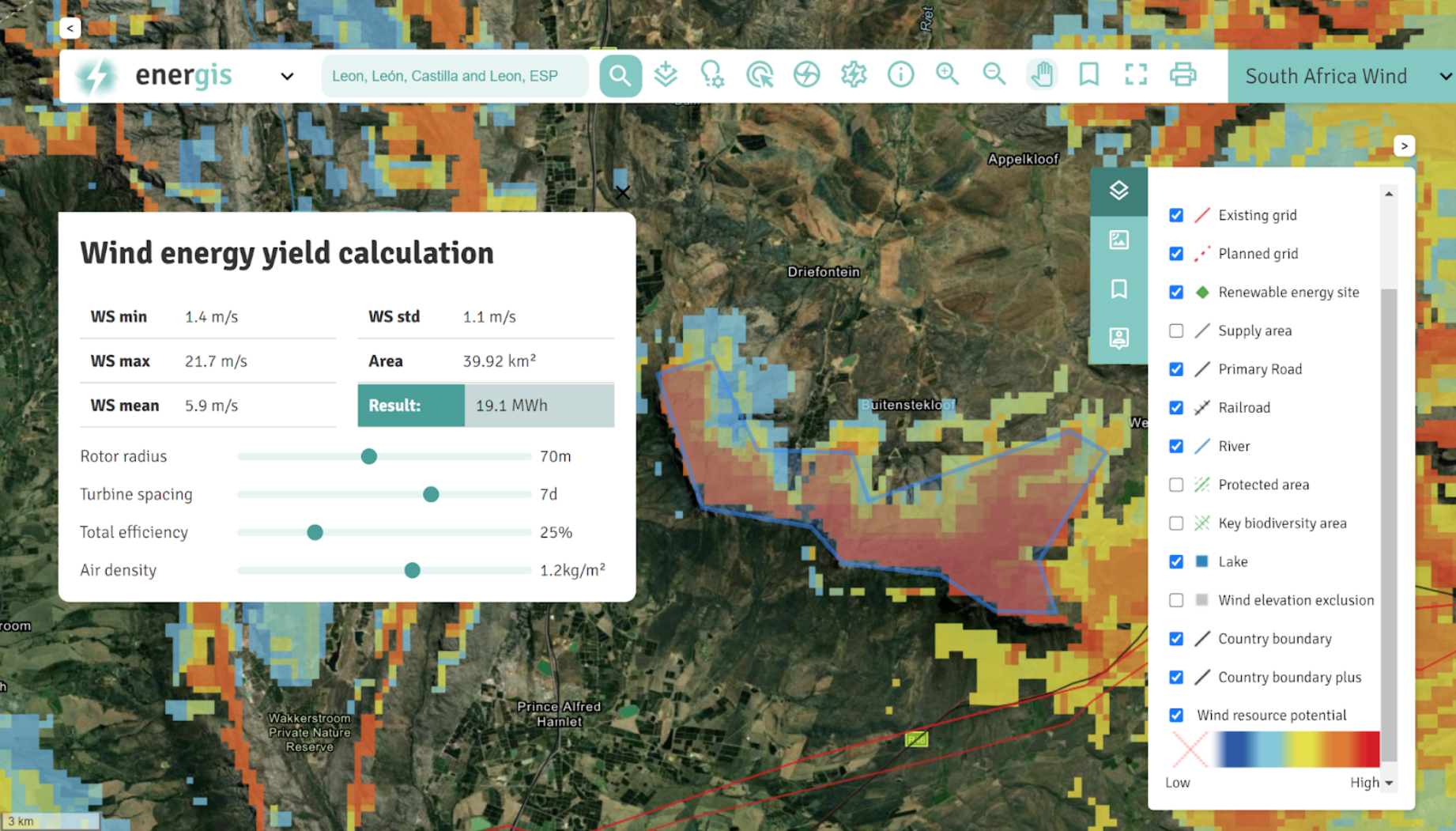
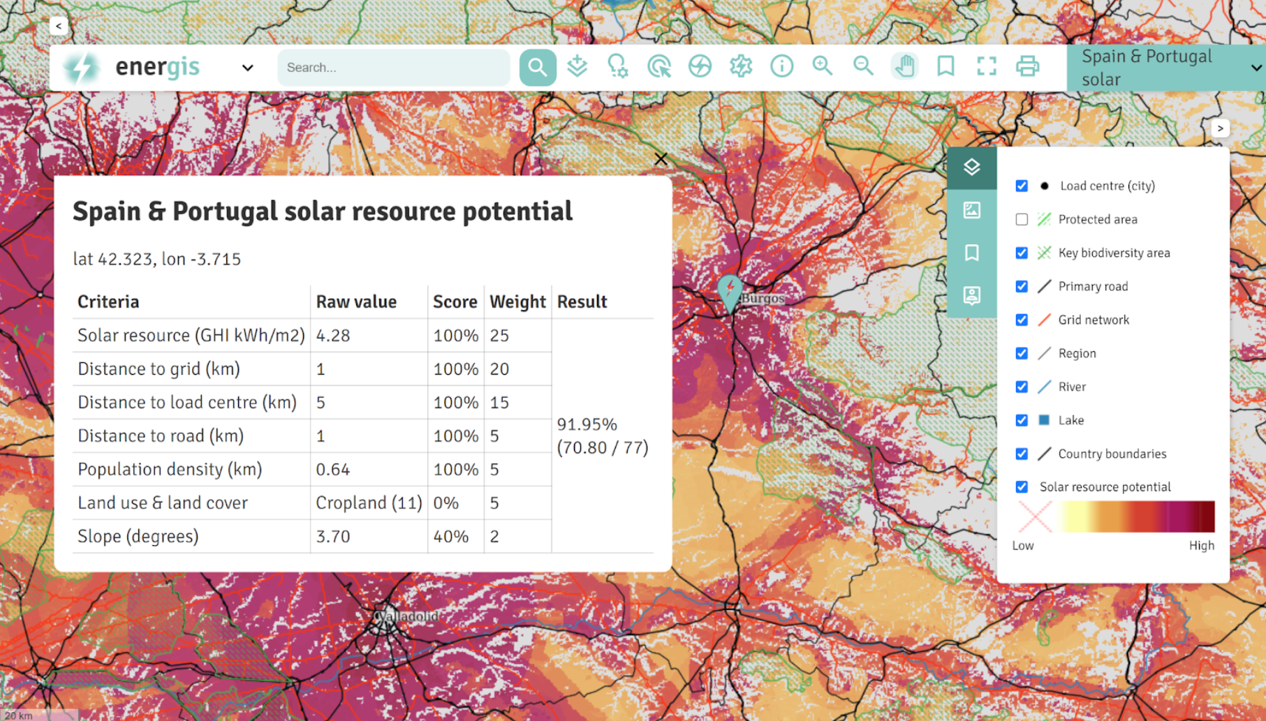
Identifying the potential of resources for the development of renewable energies is key to the successful deployment of any project. By combining a series of detailed analyzes with customized data interrogation tools, enerGIS provides early stage understanding of resource availability along with existing and future constraints such as infrastructure and protected areas, facilitating data-driven decision making.
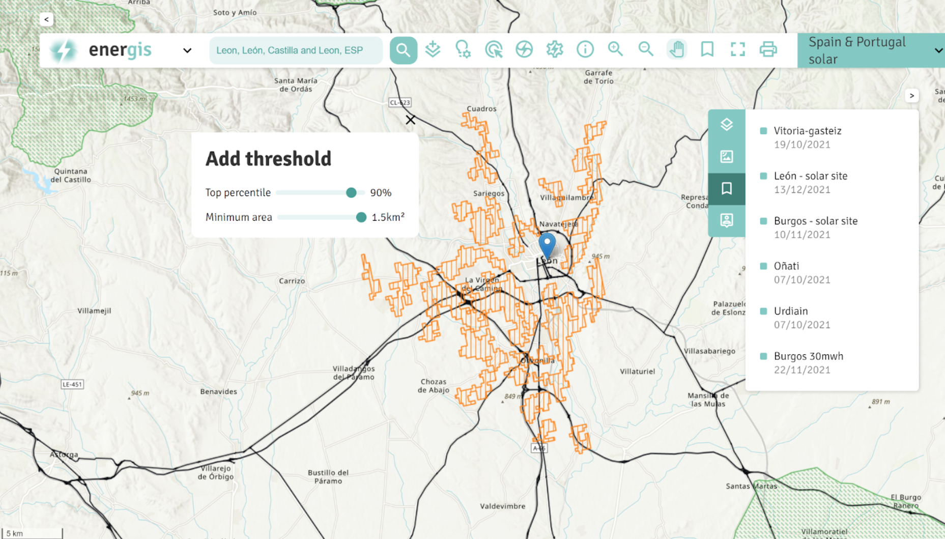
enerGIS enables the user to drill down into the model's multi-layered attributes, set data thresholds, and change input parameters to generate resource availability heat maps, all in a simple and intuitive web interface. The web mapping tool unlocks the complex insight of geospatial analysis and streamlines early stage renewable project planning.
The solution
By combining a series of detailed analyses with customized data interrogation tools, enerGIS provides early stage understanding of resource availability along with existing and future constraints such as infrastructure and protected areas, facilitating data-driven decision making.
enerGIS enables the user to drill down into the model's multi-layered attributes, set data thresholds, and change input parameters to generate resource availability heat maps, all in a simple and intuitive web interface. The web mapping tool unlocks the complex insight of geospatial analysis and streamlines early stage renewable project planning.
Our analyses cover resource thresholds, distance to infrastructure, load centre proximity, land use classifications and more; such as topography, bathymetry or environmental restrictions.
The impact
User friendly, collaborative, web-based spatial planning tool that allows data-driven decision-making for:
- Understanding resource potential of a country or region
- Proactive long-term energy transition planning
- Emerging market opportunity
- Assessing co-location of competing technologies
- Infrastructure improvement scenario modelling for grid network build-out
- Port upgrade requirements for offshore wind project support
- Site access reinforcement
- Early stage project site finding
- Initial energy yield assessment